
Close

Shop All:Delta Education
Delta Education Contour Mapping Activity Kits, Pack of 10
Item #:
110-8763
$446.69
$335.02
package_2 Free Shipping Ineligible.
Quickship Eligible.
Made to Order - Typically Ships Within 2-4 Weeks - Lead Times Vary
Help your students reach their peak potential in mastering topography (and measuring elevation, scale, and more) with hands-on contour mapping activity kits.
About This Item
Description
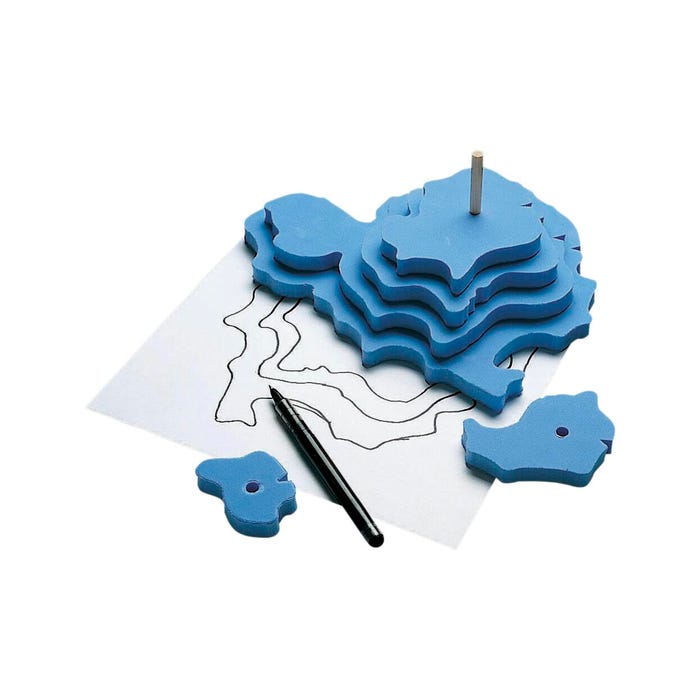
Take your Earth Science class to new heights! Delta Education Contour Mapping Activity Kits will motivate students to build and map their very own mountain formations. Six contoured foam layer "plates" allow students to build a model of various 3D landforms, as well as simulate below-sea- level landforms with a perforated box lid. Activity guide included with easy-to-follow instructions. Recommended for Grades 5 to 8.Features
- Contour mapping classroom kit provides a visual and hands-on way to learn about topography and landforms, earth science, geology, and real-life STEM concepts
- Students will learn how to draw contour lines and how to indicate an read elevations on a chart or map
- Your class will then get to see their topography drawings come to life by building 3D foam “plates” that represent landforms and the appropriate scales of measurement
- Kits are perfect for a science lesson in geology along with learning about volcanoes, valleys, canyons, and plains
- Set of 6 contour mapping activity kits for Grade 5 to 8 learners is an educational and engaging project for individual, group or class work
Set of 6 Class Activity Kits Each Include:
- Total of 36 Foam Layer "Plates" (6 Foam Layers Per Kit)
- 6 Perforated Box Lids
- Activity Guide
Shipping Type:
policy5
Free Shipping:
false
Specifications
Selling Unit of Measure:
Pack of 10
UPC:
885634094454
Specialty Shops:
Exclusive
 WARNING:
This product can expose you to chemicals including Wood Dust, which is known to the State of California to cause cancer. For more information go to
WARNING:
This product can expose you to chemicals including Wood Dust, which is known to the State of California to cause cancer. For more information go to