Close

Shop All:Rand McNally
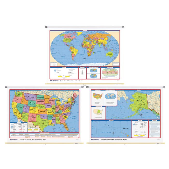
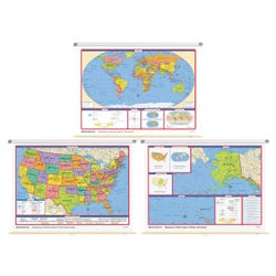
Rand McNally Elementary Political 2 Wall Map Combo
Item #:
1440888
$826.69
$620.02
package_2 Free Shipping Eligible.
Quickship Eligible.
Ships Directly from Manufacturer Typically Within 2-4 Weeks - Lead Times Vary
About This Item
Description
Rand McNally Elementary Political Wall Maps includes a world map, United States map and a map of Alaska and Hawaii. World map features bright, contrasting colors to teach size, shape and location of countries and bodies of water. Country boundaries and names are clearly shown in large easy-to-read type and makes use of the educationally sound Robinson projection. All maps are mounted on one spring roller together. The US maps features labeled state capitals, national capitals and major cities, national parks, historical sites, time zones and a US timeline with 16 key historical events. Special features covering cardinal and intermediate directions, hemispheres and continents are included. Measures 70 x 52 inches. Set of 3.Includes: 3 Maps
Shipping Type:
parcel
Free Shipping:
true
Specifications
Allergens:
Contains No Allergens
ISBN Number:
9780528027376
UPC:
070609005560
 No Choking Hazard